Daniel Smith, Frontier Surveyor (1748-1818)

by Kathy B. Lauder.

Daniel Smith was born October 29, 1748, in Stafford County, Virginia. Having made up his mind to become a doctor, he studied medicine with Dr. Thomas Walker at Castle Hill, in Albemarle County, Virginia. However, he soon made an abrupt career shift and, at the age of 22, was licensed as a surveyor by the College of William and Mary (founded in 1693).

Three years after he began working as a surveyor, he married Sarah Michie and took a position as Deputy Surveyor and later sheriff of Augusta County, Virginia, where their son George was born in 1776. Smith first came to Middle Tennessee during the winter of 1779-1780, after he was hired to survey the western region of the Virginia frontier, and particularly to chart the border between Virginia and North Carolina. During the American Revolutionary War, he was commissioned a colonel in the militia, took part in a number of battles, and was appointed Assistant Deputy Surveyor for the Southern Department of the Continental Army in 1781.  Strongly attracted to Middle Tennessee, in 1784 he claimed a land grant awarded for his military service and moved his family, which now included daughter Mary Ann “Polly,” to a 3,140-acre tract in Sumner County, where he served as the county surveyor.

Rock Castle State Historic Site, home of Daniel Smith, in Sumner County, Tennessee, was completed in 1796

After reaching adulthood, both of Daniel Smith’s children wed members of the Donelson family. George married Tabitha, the daughter of Capt. John Donelson III; Polly and Rachel Jackson’s brother Samuel Donelson eloped, with the assistance of Rachel and her husband, a circumstance that caused hard feelings between Daniel Smith and Andrew Jackson for many years*.

Mary “Polly” Smith Donelson (Tennessee Portrait Project)

In 1783 Daniel Smith was appointed both county surveyor and justice of the peace for Davidson County (still part of North Carolina at that time), and helped to survey the state military land-grant reservation in the Cumberland valley. One of the five trustees responsible for overseeing the establishment of the City of Nashville, he was also a charter trustee of Davidson Academy, the first institution of higher learning in Nashville. This school, founded in 1785, would over the years be transformed into Cumberland College (1806), the University of Nashville (1826), the Peabody Normal College at Nashville (1875), and finally the George Peabody College for Teachers, now part of Vanderbilt University.

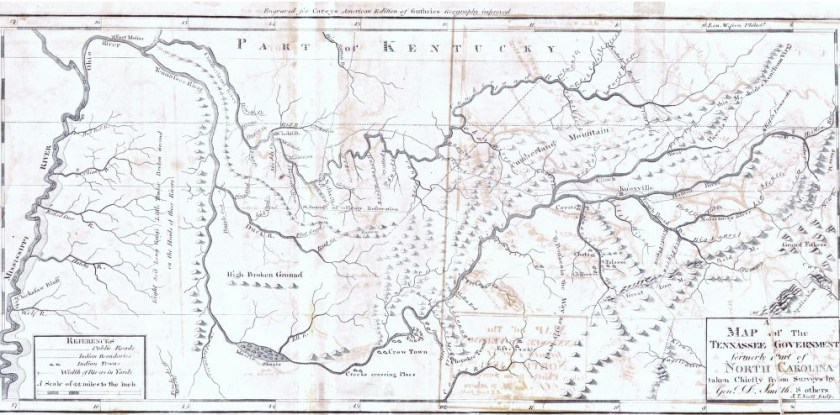
When Sumner County was created in 1786, Daniel Smith, as justice of the peace, presided over the first session of the Sumner County Court. Two years later he was named Commanding General of the Mero District (Sumner, Davidson, and Tennessee counties), and in 1789 he was a member of the North Carolina convention that voted to ratify the United States Constitution. In 1790 Smith was appointed by President George Washington to become secretary of the Territory of the United States South of the River Ohio, with authority to act for the territorial governor in his absence. The first map of the region, created in large part from Smith’s own surveys, was published during his term as secretary.

1795 Tennessee map based largely on Daniel Smith’s surveys (courtesy Alabama Department of Archives and History)

Daniel Smith held the post of territorial secretary until 1796, when the territory became the State of Tennessee. Smith was a member of the 1796 Convention and chaired the committee that wrote the young state’s first Constitution and Bill of Rights.

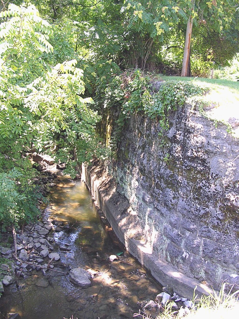
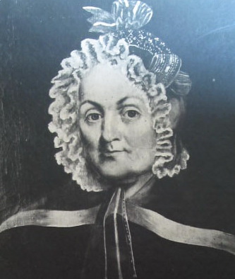
During the first decade of the 19th century, Smith played a key role in negotiating a series of treaties with the Cherokee. He was appointed to serve several months of Andrew Jackson’s unexpired term in the U.S. Senate (after Jackson resigned to serve on the Tennessee Supreme Court), and in 1804 was elected to his own full term in the Senate. Unfortunately, he was forced to resign from the Senate in 1809 because of ill health. He and Sarah remained at home for several more years, overseeing various farm and business interests from their Sumner County plantation house, Rock Castle, which still stands on Drake’s Creek in Hendersonville. He died there on June 16, 1818, at age 69. Both Daniel and Sarah, who died thirteen years after her husband, are buried in the family cemetery at Rock Castle. Smith County, created while Daniel was still very much alive, was named to honor his service in the Revolutionary War and his many other contributions to the development of the state of Tennessee.

Smith family cemetery at Rock Castle (Daniel and Sarah’s grave markers are the table-like platforms at upper right behind the obelisk)

* Note: This was not the only time Andrew and Rachel Jackson helped a young couple elope! See also https://nashvillehistoricalnewsletter.com/2021/11/20/til-death-do-us-part-love-and-devotion-at-city-cemetery/

Major John Buchanan (1759-1832)

by Mike Slate.

John Buchanan was a Scots-Irish American who emigrated to the French Lick in late 1779 and helped found the town of Nashville, at that time considered part of back-country North Carolina. Born in Harrisburg, Pennsylvania, on January 12, 1759, young Buchanan and his party arrived at the Lick shortly before the James Robertson and John Rains groups, and began building cabins. Along with the Buchanans were sundry other first comers, including Daniel and Sampson Williams, James and John Mulherrin, and Thomas Thompson.

Battle of the Bluffs

Not long after the establishment of nearby Fort Nashborough on a site called “the Bluffs” overlooking the Cumberland River, John’s brother Alexander was killed in the well-known “Battle of the Bluffs” on April 2, 1781. During this same Indian attack John’s father, John Buchanan Sr., heroically saved pioneer Edward Swanson from almost certain death. The following summer, John compiled early Nashville’s first book: John Buchanan’s Book of Arithmetic, dated June 20, 1781. A kind of personal workbook likely prepared under the tutelage of teacher James Mulherrin, the fragile volume survives today at the Tennessee State Library and Archives. John used the book to learn the mathematics of land surveying, a profession he later pursued with lucrative success.

A page from John Buchanan’s Book of Arithmetic, currently stored in the Tennessee State Library and Archives.

In 1784, after the town of Nashville was officially recognized and laid out in grids, the Buchanans, apparently not wishing to live as town folk, moved a few miles southeast to Mill Creek and built their own outpost called Buchanan’s Station. Located at today’s Elm Hill Pike and Massman Drive in the Donelson area, the station and its 640-acre tract served as John’s home until his death in 1832. He also built a grist mill, well-known as Buchanan’s Mill, and one of Nashville’s earliest roads was cut from old Fort Nashborough out to the mill.

In 1786 John married Margaret Kennedy, with whom he had one child, John Buchanan III. Their descendants included Tennessee governor John Price Buchanan (1847-1939) and modern Nobel Prize winner James McGill Buchanan Jr. (1919-2013). Four years after Margaret’s untimely death in 1787, John married Sarah “Sally” Ridley, daughter of pioneer Captain George Ridley. The legendary Sally would bear thirteen more Buchanan children.

Mill wheel

Initially a lieutenant and then a captain in the local militia, by 1787 John had gained the title of major. Although he is often called “Major John” today, the circumstances that led to this rank are not known, and one speculation is that it was honorary in nature. John’s militia service reached its zenith on September 30, 1792, when Buchanan’s Station was attacked by a large confederacy of Indians from several tribes, a storied event that resulted in a dramatic victory for the Cumberland settlers.

Over the years John Buchanan served on numerous juries, surveyed countless parcels of land for other settlers, and accumulated thousands of acres for himself and his family. Having arrived on the lower Cumberland with only a few possessions on pack horses, he died a prosperous man on November 7, 1832, having realized the American pioneer’s dream.

The Suspension Bridge (1850)

by Allen Forkum.

Since settlers first arrived in 1779, there has been a need for residents to cross the Cumberland River at Nashville. Boats and ferries were the primary means until Nashville’s first bridge was completed in 1823. But within years, this covered toll bridge became an impediment to steamboat traffic, and petitions were made to the state for a second bridge.

View of Cumberland River, looking north, with view of the Woodland Street suspension bridge and railroad bridge in the distance. (from TSLA photograph collection)

In December 1845 the state legislature authorized the Broad Street Bridge Company to “erect a suspension bridge, of sufficient height as to not obstruct the navigation of the Cumberland” located “at or near the junction of Broad and Water streets” (today’s Riverfront Park). The public act dictated toll rates, e.g., “Footmen free; Man and horse, 5 cents. . . ; For any four wheel two horse pleasure carriage, 25 cents,” etc. Charter company members included Felix K. Zollicoffer (1812–1862) and John Shelby (1785–1859), who owned land across the river in the community that would become known as Edgefield. After the location of the bridge was fixed (changed from Broad Street to the Public Square), contractor M.D. Field hired Nashville architect Adolphus Heiman (1809–1862) to design the bridge. Heiman’s work was lauded, but he would resign from the project over disagreements with Field about the bridge’s construction. By August 1850 the “wire suspension bridge” had “hundreds of wagons and other vehicles pass over daily.” The toll bridge officially opened on September 23. It was 663 three feet in length and 110 feet above the low-water mark. One historian said the “magnificent structure . . . gave an impetus to the growth of Edgefield, making desirable a large body of land which was not so well reached by the old bridge.” The old covered bridge was removed in 1851.

On June 16, 1855, disaster struck at the suspension bridge when a portion of the roadway collapsed, sending a carriage and several people plummeting into the river; two people were killed. Newspaper accounts attributed the accident to brittle wood being used to replace the old wood flooring.

On February 18, 1862, despite “urgent appeals” by citizens, retreating Confederate military authorities ordered that the suspension cables be cut to impede advancing Federal troops. John B. Lindsley (1822–1897) witnessed the destruction of the bridge, writing in his diary that he had never seen a “more strikingly beautiful scene . . .the Wire Bridge was a line or flooring of fire.” The railroad bridge was also burned. Federal military authorities formally took possession of the city on February 25.

The suspension bridge was rebuilt in 1866 and reopened again as a toll bridge. But by the 1870s some citizens, particularly those on the Edgefield side of the river, were expressing the desire for a free bridge. In 1882 the city and county jointly purchased the suspension bridge from the Broad Street Bridge Company and reopened it for public use without a toll. Just two years later, however, the bridge was deemed unsafe by engineers and closed. It was agreed that a new bridge would be erected, but to the chagrin of many Edgefield residents, a pay ferry and a toll pontoon bridge had to be used in the meantime. The new bridge, featuring new piers and iron truss spans with two roadways, opened in 1886. Today the Woodland Street Bridge, opened in 1966, crosses the Cumberland River at the same location as the original 1850 suspension bridge.


Sources, abridged:

Chronicles of the Cumberland Settlements (2012), by Paul Clements, page 131.

Nashville Whig, June 11, 1823, “Nashville Bridge.”

Tennessee Legislative Petitions, Record Group 62 card catalog, bridge petitions.

Tennessee Legislative Petitions, 194-1831-1A and 194-1831-1B, petition by Nashville Bridge Company against a second bridge.

Public Acts of Tennessee, 1845-46, Chapter XXVI, pages 71 to 74, authorization of the suspension bridge.

A. Heiman to John Meigs, Dec. 28, 1857, Tennessee Historical Society Miscellaneous Files (T-100) Box 7, H-62, copy of resignation letter.

A. Heiman to John Meigs, Dec. 28, 1857, Tennessee Historical Society Miscellaneous Files (T-100) Box 7, H-63, copy of report to Directors of the Suspension Bridge

Nashville Union, April 18, 1849, “Suspension Bridge.”

Daily (Centre-State) American, August 17, 1850, “The Wire Suspension Bridge…”

History of Davidson County, Tennessee (1880) by W.W. Clayton, pages 308–309, 348.

Daily American, November 13, 1851, “The work of removing the Bridge…”

Nashville Union & American, June 17, 1855, “Terrible Casualty.”

Republican Banner, June 17, 1855, “Unfortunate Accident at the Suspension Bridge.”

Republican Banner, June 19, 1855, “The Bridge Casualty.”

“The Great Panic by an Eye-witness” (1862) booklet

Lindsley, John B., diary, February 20, 1862, “By this time (3 to 4 A.M.) the suspension and railroad bridges were all in flames.”

Republican Banner, April 21, 1866, “The Suspension Bridge over the Cumberland river, connecting Nashville with the pleasant suburb of Edgefield, will be completed in a few weeks.”

Republican Banner, September 23, 1870, “To The Editor” from “Stockholders” regarding “free passage”

Daily American, January 12, 1882, “The Suspension Bridge—The Resolution Proposing Its Condemnation for a Free Bridge.”

Daily American, September 11, 1884, “The New Bridge.”

Daily American, April 18, 1886, “Crossing The River—History of Bridges Across the Cumberland at Nashville.”

Nashville Banner, October 22, 1966, “Man Survives 90-Foot Fall Off Bridge.”

“Nashville Bridges Across the Cumberland River,” by Debie Cox, online at http://nashvillehistory.blogspot.com/2008/09/nashville-bridges.html

A Souvenir from the 1920s

Primary Source Document, transcribed by Mike Slate.

Yesteryear’s folding booklets of postcards sometimes included a few paragraphs about the featured state or city. The text below, which reads as though it might have been prepared by the local Chamber of Commerce, came from a booklet of postcards published by S. H. Kress & Co. and is hand-dated September 15, 1924. Ephemera like this can often provide both interesting data and thought-provoking interpretive possibilities.

NASHVILLE, TENNESSEE

Nashville is the Capital City of Tennessee, and the County Seat of Davidson County.

Four railroads serve the city. Forty-four passenger and sixty-eight freight trains arrive in Nashville daily.

The Cumberland River is navigable 210 miles down the river practically the year round and 352 miles up the river for about six months, and the work of installing new locks and dams will increase this practically to ten months each year. Nashville has seven bridges across the Cumberland River.

There are 22 parks and playgrounds, containing 468 acres. Centennial Park has the only replica of the Parthenon in the world. Shelby Park has a nine-hole municipal golf course. The Vanderbilt Stadium seats 22,000 people, and is the largest athletic field in the South. Nashville’s water supply is pure and inexhaustible, with more than 50,000,000-gallon capacity daily. The Tennessee State Fair, one of the largest expositions in the South, is held in Nashville each year. The Public Auditorium has a seating capacity of 5,000 persons.

Nashville’s Parthenon is the only full-size replica of the original building.

Vanderbilt University, with assets of $11,000,000, has entrance requirements and a curriculum equal to any university in the United States, and has drawn students from every state in the Union and from eight foreign countries. It has an endowment of $6,850,000. The medical department has an endowment of $3,500,000, and is erecting the most complete medical school in the South and one of the finest in America.

The only Y.M.C.A. College in the South is located in Nashville.

Three institutions for women, Ward-Belmont, St. Bernard Academy, and St. Cecilia, draw students from practically every state in the Union. Ward-Belmont alone has over 600 non-resident students.

Ward-Belmont School (postcard from NHN collection)

The Southeastern School of Printing has $80,000 worth of equipment, and is the only school of its kind in the South.

The United States government recognizes as colleges only three institutions for the higher education of the Negro; two of them, Fisk University and Meharry College, are located here; also Walden University, Tennessee Agricultural and Industrial Normal School, Roger Williams, and two Negro Baptist Theological Seminaries.

The Fisk Jubilee Singers have sung in every Capital and at every court in Europe.

The Fisk Jubilee Singers: from left, B. W. Thomas, Julia Jackson, Maggie Porter, Ella Sheppard, F. J. Louden, H. D. Alexander, Georgia Gordon, Jennie Jackson, America Robinson, Thomas Rutling

George Peabody College for Teachers, with an investment of $4,000,000 and 20 departments, is the only teachers’ college in the South, and the second largest in the United States. It has an endowment of $2,500,000, and in 1922-23 had an enrollment representing 36 states and 5 foreign countries.

It leads all other cities in the South in livestock, butter, poultry, grinding of wheat, eggs, and various agricultural products.

The mean annual temperature is 60 degrees; the average summer temperature is 78 degrees; and average winter temperature is 41 degrees.

The average annual rainfall is 47.2 inches, humidity moderate, and no sunstrokes are recorded.

Nashville has more than 500 manufacturing enterprises, makes more self-rising flour than any city in the world (“Goodness gracious, it’s good!”), and is one of the two largest hardwood flooring markets in the world. Its annual hardwood flooring output would pave an automobile boulevard 10 feet wide from Nashville to New York. Over 35,000,000 pounds of green coffee are roasted annually.

The Hermitage, the home of Andrew Jackson, is located near Nashville, and is one of the show grounds of America.

Three Presidents of the United States, Andrew Jackson, James K. Polk, and Andrew Johnson, have lived in Nashville. Jackson is buried at the Hermitage and Polk on the grounds of the historic State Capitol.

Tomb of President James K. Polk

Five Nashville men have sat in the Supreme Court of the United States: John Catron, Howell E. Jackson, Horace H. Lurton, J. C. McReynolds, and E. T. Sanford.

The Battle of Nashville, one of the major engagements of the Civil War, was fought partially within the city limits on December 15 and 16, 1864.

William Driver, a New England sea captain who named the American flag “Old Glory,” is buried in the old City Cemetery.

William Driver reenactor at a recent City Cemetery Living History tour

William Walker, the “Grey-eyed Man of Destiny,” the most famous of all American filibusters, was born and reared in Nashville. Walker became president of Nicaragua and raised the blood-red five-point star of the United States of Central America, but he failed in his plans and was shot by a firing squad.  (1997)

Nashville Founding Factors

by Mike Slate.

It’s difficult to imagine when Nashville wasn’t here—when Davidson County was a game-rich but otherwise uninhabited wilderness. Yet that’s the way it was 250 years ago. Who started all this civilization that we now take for granted and call our home? The traditional view is that Nashville was founded by pioneers James Robertson and John Donelson, who journeyed here in 1779-80 with a few hundred others, built a fort on the bluff above the Cumberland River, and persevered through much danger and hardship. The arrival of Robertson and Donelson was certainly the pinnacle of an uphill process, yet other founding factors are worthy of more emphasis than they sometimes receive.

For example, we should not forget the buffalo. The huge hump-backed beasts flourished here near the river and made paths to a salubrious spot in the vicinity of Sulphur Dell ballpark and the Bicentennial Mall. That spot was a salt lick on a creek called Lick Branch, long since smothered by modern infrastructure. So many bison and deer were here that reports from early hunters and explorers made our area attractive to adventurous colonials back east. Yes, our metropolis rides atop buffalo humps: without the bison there may never have been a Nashville, a circumstance that illustrates the interdependence of geographical, natural, and human history.

Painting from NHN collection

Despite 200 years of study the next factor remains mysterious and fraught with theory. Generally, we know that over the eons distinctly different cities were often built one on top of another. Nashville has risen upon a Mississippian-era culture commonly known as the Mound Builders, Indians so ancient that even the more modern Native Americans didn’t know where they came from or where they went. When early woodsmen arrived at our salt lick they found an old earthen mound close by, obviously man-made and apparently ceremonial in function. Ralph Earl, Andrew Jackson’s portrait artist, excavated the mound in 1821 and found the round base to be about thirty yards in diameter and the height about ten feet. Situated generally from the mound eastward to the Cumberland, an ancient burial ground held interments enough to indicate that a large population thrived here. These remains of a surprisingly sophisticated society were a few to several centuries old. In addition to Davidson County finds, other such sites were discovered in surrounding counties and across Tennessee—all a part of a nexus that extended throughout much of the Ohio River Valley and beyond. Was the existence of a previous society an encouragement to later pioneers? Did early Nashvillians assume, consciously or not, that since another culture had flourished here, so could they?

Photo by Paul Pierce

After the era of the Mound Builders, the Shawnee Indians also had villages along the Cumberland. In fact, an early name for the Cumberland River was the “Shawanoe,” an English derivative of the French “Chaouanon.”   The Shawnee were a rather nomadic tribe, but for a time they had a village near our salt lick, until driven north in about 1714 by Cherokee and Chickasaw tribes who sought to reserve Middle Tennessee for hunting only. Thus for many years before the Euro-American settlers arrived, our Middle Tennessee area was a kind of sacred game preserve. No wonder the Indians were enraged when the white man came. However, the settlers, knowing good land when they saw it, determined to have it regardless of the price they had to pay. That price was paid in blood, as Indian wars raged for the first fifteen years of white settlement. Evidently, no real estate is more desirable than that which someone else also desires!

During and after the Shawnee period, French hunters and traders headquartered at our salt lick. Around the year 1710 a young apprentice, Jean du Charleville, worked here for an old Frenchman whose name is lost to history.  Their trading post was located directly on top of our Indian mound. Arriving in the 1760s, another hunter-trader bore an auspicious name: Jacques Timothe Boucher de Montbrun. More commonly known as Timothy Demonbreun, he returned in later years to settle in Nashville, and today’s Demonbreun Street is named for him. Because of the intermittent presence of such French entrepreneurs, our locale became known as the French Lick, a name familiar to researchers of the American frontier. A remnant of French influence survives today in the word “Nashville,” the suffix -ville being French for town or village.

On the heels of the French traders came the Long Hunters, so called because of the lengthy time they spent in the woods. Notable hunters and explorers in our region during the 1760s and 70s include Thomas Hutchins, Henry Scaggs, Uriah Stone, Michael Stoner, Kasper Mansker, Isaac Bledsoe, Thomas “Bigfoot” Spencer, James Smith, John Rains, Daniel Boone, and John Montgomery. History knows a fair amount about these trailblazers, and their romantic era is fittingly memorialized in the name of today’s Long Hunter State Park along Percy Priest Lake. Serving as the vanguard of colonial civilization, the Long Hunters laid the foundation necessary for permanent settlement.

The Long Hunters gave rave reviews of the western wilds to a North Carolina judge, Richard Henderson, who was interested in land speculation. Together with like-minded partners, Henderson established a land company, the Transylvania Company; and in 1775 he negotiated with the powerful Cherokee Indians to gain tentative control of much of today’s Kentucky and upper Middle Tennessee territory, including the French Lick. He then organized emigrant groups to settle both the Kentucky and Cumberland regions, with Daniel Boone the head of the Kentucky contingent and James Robertson the Tennessee leader. Robertson, a North Carolinian, teamed with Virginian John Donelson and devised a plan to conduct a few hundred pioneers from northeastern Tennessee to the French Lick, Robertson by land and Donelson by river. Robertson’s group arrived here in December 1779 and built the fortification overlooking the Cumberland, and Donelson’s voyagers arrived the following April. A number of the newcomers established other stations nearby. Close behind the settlers came Henderson, who then penned our first organizational document—the famous Cumberland Compact—in which he referred to our compound as “Nashborough,” in honor of General Francis Nash who had recently died in the Revolutionary War. Some 256 men signed the Compact, and the primitive village was up and running, along with its sister stations.

But Nashborough had no real legitimacy. It was only a speck of civilization separated by hundreds of rugged miles from its territorial mother, the State of North Carolina. Finally, in 1783-84, the North Carolina legislature recognized it, upgrading the outpost to the status of a town in the new county of Davidson and changing its name to Nashville, an apparent attempt to disavow the English with whom the Revolutionary War was just ending.      

Of our Nashville founding factors—buffalo, Mound Builders, Shawnee, French hunters-traders, Long Hunters, Henderson, Robertson and Donelson, North Carolina legislature—perhaps the most under-appreciated is frontier opportunist Richard Henderson. So instrumental was his role in our beginnings that if someone were to claim him as our founding father it would be difficult to argue the point. While it is Robertson who is proudly and justifiably known as the “Father of Middle Tennessee,” Henderson was the CEO behind the initial enterprise. He didn’t do the heroic grunt work or Indian fighting necessary for our permanence, but he was our prime mover.

Like the trees that obscure the forest, hidden within the “how” of our founding is the “why.” Why did the founders come to this particular place? Nashville’s founding factors provide a fundamental answer: the colonial settlers were drawn to this location because it already had a magnetic history.


Helpful sources: Haywood’s The Natural and Aboriginal History of Tennessee, 1823; Goodspeed’s History of Tennessee, 1887; Thruston’s Antiquities of Tennessee, 1890; Williams’s Dawn of Tennessee Valley and Tennessee History, 1937; Arnow’s Seedtime on the Cumberland, 1960; Crutchfield’s Early Times in the Cumberland Valley, 1976; Satz’s Tennessee’s Indian Peoples, 1979; Hinton’s A Long Path, 1997; Finger’s Tennessee Frontiers, 2001.


This article was originally published in the September 2009 issue of The Nashville Retrospect. We thank publisher Allen Forkum for his permission to republish it here.

Six Triple-Threat Town Sites

by Guy Alan Bockmon.

In his 1930 book Soil, Its Influence on the History of the United States, Archer Butler Hulbert noted that the locations of the early “ferries . . . mark the . . . points where the ancient trails descended from high ground to the fords. These were usually located on a river at the mouth of a loading tributary. The sediment of this tributary was deposited blow [sic] its mouth in the main river, making the water shallower at that point and therefore more easily forded. About such fords human habitations usually sprang up in the shape of trading cabins, villages, or forts.”

At six such sites there sprang up the first tiny villages on the Cumberland and Red Rivers in Middle Tennessee.

The village of Nashville grew up around the 1780 fort sited on a defensible bluff accessible from the river via Lick Branch. The Lick Branch shoal was augmented by that of Pond Branch, which flowed into the Cumberland from the opposite side.

A little more than a mile downstream from Nashville, and on the other side of the river, Heaton’s (or Eaton’s) Station was also established in 1780, at a location near where Well’s Mill Creek loaded into the Cumberland. The station had prospered sufficiently to be called Heatonsburg in the 1783 minutes of the Notables. Historian A. W. Putnam (1799-1869) believed the town of Waynesborough was laid out at Heaton’s Station about 1796. This new town, a rival to Nashville, was given its name in honor of General Anthony Wayne.

Clarksville, the second settlement in Middle Tennessee to survive as a town, was sited on the east bank of the Cumberland, just above the mouth of the Red River. Local historian W. P. Titus observed that Clarksville had the advantages of two rivers, good landings, and, what was then indispensable, a gushing spring of pure water.

A few miles downstream from Clarksville, Deason and Weaver Creeks had combined forces over geological time, carving a deep notch into the high limestone bluff. At that spot on the south shore, downstream from the mouth of the north shore’s Hog Branch, the village of Palmyra began to prosper in its role as the country’s international port nearest to the Gulf of Mexico. Jonathan Steele, Comptroller of the Treasury from 1796-1802, noted that the appointment of one Morgan Brown as Collector had been approved upon the information of Andrew Jackson, then a Senator from Tennessee.

About ten miles east of Clarksville, where Sulphur Fork Creek flows into the Red River, the village of Port Royal was laid out, as described by C. E. Brehm*, into 37 lots, four streets, a public square and a section of land reserved for a public warehouse.

Upstream from Nashville about six miles is the mouth of Spencer’s Spring Branch. It was later to be called, successively, Buchanan’s Spring Branch, Craighead’s Spring Branch, and Love’s Spring Branch. On its banks by 1799 was established the village of Haysborough.

Only a few fords and ferries are still in use, as are even fewer portages. The cities of Nashville and Clarksville still thrive. Palmyra still exists. The site of Port Royal is now a State Park. The historic villages of Haysborough and Waynesboro have disappeared from modern maps. The triple threat of fording place, portage, and harbor at these six sites and many others largely determined where future settlements, roads, ferries, bridges, and eventually railroads would be located. Thus did sedimentation influence settlement.


* Cloide Everett Brehm (1889-1971) was president of the University of Tennessee from 1946-1959.

A Pioneer History of Stone’s River near the Clover Bottoms

by Amelia Whitsitt Edwards.

One of the most popular features of the Donelson area is a paved greenway trail system along the banks of Stone’s River from the Percy Priest Dam to the Cumberland River. The trail winds through the Clover Bottoms, an area of prime importance to the early settlers in the Nashville area.

Scene on the greenway trail (from NHN collection)

The pioneer story began in 1766 with the exploration of the Long Hunters. The river was named in honor of one of their group, Uriah Stone. These adventurers carried the story of this bountiful, uninhabited land with them when they returned to Virginia and North Carolina. It was fourteen years, however, before the first settlers arrived.

In the spring of 1780, John Donelson, having led the flotilla of settlers to Nashborough, recognized the need to plant a corn crop immediately. He again boarded the good ship Adventure with his family, poled up the Cumberland around the great bend until he found the mouth of Stone’s River. He was looking for alluvial fields that were as fertile as the Valley of the Nile and which needed no clearing in order to plant.

The Donelson Party arrived on flatboats

A short distance from the confluence of the two rivers he found what he was looking for on the west bank of Stone’s River*, an area forever after known as the Clover Bottoms. Here he docked his boat and built half-faced shelters to house his family on the opposite bluff. This was fifteen-year-old Rachel Donelson’s first home in Tennessee.

That July heavy rains inundated the corn crop. This unhappy event, plus constant harassment from the native Indians, forced the family to move to Mansker’s Fort for protection.

By fall, word reached the settlers at Mansker’s that the flood waters had subsided and that the corn had eared. John Donelson sent a request to the men at Fort Nashborough to meet him at the Clover Bottoms to help harvest the corn. Approximately ten men from each fort built wooden sleds to drag the corn from the field to the boats moored in Stone’s River. Several days were required to load the boats.

As they left the shore, the boat from Fort Nashborough was attacked by Indians; only three settlers escaped with their lives. The Donelson party was on the north bank, harvesting the cotton planted there. They abandoned their boat loaded with corn and managed to get away on foot through the woods. Donelson’s heroic slave, Somerset, swam the Cumberland River and brought help from Mansker’s Fort to the stranded group.

Meanwhile, the boat from Fort Nashborough floated downstream, eventually reaching the bluffs with its tragic cargo of corn and slain men. The settlers there rescued the corn and buried their dead.

Some years later Andrew Jackson, who had married Rachel Donelson, operated several businesses along the Stone’s River corridor. He first opened a general store near the Clover Bottoms. In order to stock his store, he went to Philadelphia and traded land preemptions for flour, sugar, piece goods, and pocket knives. The store was a two-story building near today’s Downeymead Drive.  C. Lawrence Winn, a descendant of Jackson’s adopted son, built a house on the property in 1960.

In 1805 Jackson, with two partners, formed the Clover Bottom Jockey Club. A race track and tavern were built by the river. The story of Jackson’s duel with Charles Dickinson is well known. The unfortunate quarrel that sparked the duel started at this race track.

A story that is not so well known is that of Jackson’s boat yard on Stone’s River, near its mouth. Here he constructed five flat boats and one keel boat for former Vice President Aaron Burr who was leading a group of colonists to lands he had acquired in Louisiana. In 1812 Andrew Jackson became a military officer and began his lengthy pursuit of both a military and a political career. Thereafter his business interests on Stone’s River faded away.

A Donelson creek (from NHN photo collection)

The large tract of land known as Clover Bottom Plantation came to be owned by Dr. James Hoggatt, who built the ante-bellum mansion on the property. The property was sold to Mr. Andrew Price in the late 19th century, and then to A.F. and R.D. Stanford in the early 20th century. After World War II it was sold to the State of Tennessee.

Although the last several years have brought considerable business development to the Clover Bottoms, much of the river bank remains untouched by man. The Greenway Project is a promise to maintain the natural beauty of this historic site and preserve it for our future generations. (2000)


* Historians surmise that John Donelson’s cornfield was located just west of the Stone’s River bridge, in the general area of today’s Jackson Downs (Target) shopping center, which was named, incidentally, for the racetrack Andrew Jackson later built slightly northeast of that location.

Daniel Boone in Nashville

by Mike Slate.

Legendary frontiersman Daniel Boone (1734-1820) is most often associated with blazing the Wilderness Road through the Cumberland Gap in 1775 and establishing Kentucky settlements. However, his many wide-ranging expeditions arouse our curiosity as to whether he also explored Middle Tennessee in general and the French Lick-Nashville locality in particular. Kentucky’s plucky pioneer has generated a torrent of literature, and I invite the reader to hike with me down the Nashville fork of the Boone trail. Along the way I think we’ll find that history’s subplots are both interesting and informative.

(photo by Bob Bowman)

Daniel Boone’s short “autobiography,” romantically ghostwritten by Kentucky land speculator John Filson (ca. 1753-1788) and published in 1784, launched the intrepid woodsman to national and international fame. A pertinent but inconclusive sentence therein reports that Daniel and his brother Squire Boone (1744-1815) “proceeded to Cumberland river, reconnoitring [sic] that part of the country until March 1771, and giving names to the different waters” (The Adventures of Col. Daniel Boon, Kessinger reprint, p. 56). The Life of Daniel Boone, the seminal tome of renowned archivist Lyman C. Draper (1815-1891), seems to place this exploratory event within a geographical swath ranging from near today’s Bowling Green, Kentucky, south to Castalian Springs (formerly Bledsoe’s Lick) in Sumner County, Tennessee (see p. 264 of the Stackpole Books edition, edited by Ted Franklin Belue). One contemporary writer, Robert Morgan, expands this expedition even farther south, all the way to the French Lick (Boone: A Biography, p. 121).  

Draper reports a more conclusive episode – occurring as much as two and a half years after the exploratory journey mentioned above – in this fascinating passage: “During this period, one Joe Robertson, an old weaver who had a famous pack of bear-dogs and was devoted to the chase, often accompanied Boone into the Brushy Mountain and over to the Watauga, securing loads of bear-skins, which they packed to the settlements and sold. On one of their adventurous trips, they penetrated as far as the French Lick on Cumberland and found several French hunters there” (pp. 283-284). Here we have the earliest narrative I know that places Boone squarely in the heart of Nashville. The time frame for this visit is some seven or more years before the town was founded in 1779-80 by James Robertson (1742-1814) and John Donelson (ca. 1718-1785). Incidentally, I have discovered no familial kinship between Joe Robertson and Nashville co-founder James Robertson, yet the possibility remains intriguing. Furthermore, the fact that French hunters/traders occasionally headquartered at the salt lick on the Cumberland River known as the “French Lick,” site of today’s Nashville, has always been known, the most famous of these traders being Timothy Demonbreun (1747-1826), Nashville’s “First Citizen.”

Through the years other biographers have repeated Draper’s account of Boone at the French Lick: Reuben Gold Thwaites (1853-1913), though he places Boone “sometimes with one or two companions” but not with Joe Robertson or his dogs specifically; John Bakeless (1894-1978); and more recently, historians John Mack Faragher and Michael A. Lofaro. In his acclaimed 1992 chronicle, Faragher sometimes even tags the event with seasons: “Whether with his family or alone, Boone certainly spent the fall and winter of 1771-72 hunting in what would become the state of Tennessee. With a North Carolinian named Joe Robertson, the owner of a notable pack of bear-tracking hounds, he hunted bear, pushing as far west as French Lick (later called Nashville) on the Cumberland River, where he met hunters of some of the numerous French parties that came to those licks each year to hunt buffalo” (Daniel Boone: The Life and Legend of an American Pioneer, p. 88).

Other than in biographies, I am aware of no complete reference to Draper’s Boone-at-French Lick anecdote in any other Nashville or Tennessee history. The most obvious reason is, of course, that for well over a century Draper’s Boone manuscript existed only in handwritten form and often only on hard-to-read microfilm, until Murray State University’s Ted Franklin Belue brought it to print in 1998. Several state and local historians, however, do place Boone at least in the Middle Tennessee area. A.W. Putnam (1799-1869) notes that “Boone, Rains, Mansker, and others . . . hunted and explored in 1769-70 upon the Cumberland” and reported “its marvelous herds of buffalo and deer” (History of Middle Tennessee, University of Tennessee edition, p. 619). Similarly, Samuel Cole Williams (1864-1947) comments in his discussion of 1769-70 exploratory crews that “Daniel Boone after a hunt in Kentucky joined one of the groups on the Cumberland in the Tennessee region” (Dawn of Tennessee Valley and Tennessee History, Watauga Press edition, p. 330). Harriette Simpson Arnow (1908-1986), who used Draper and many other primary sources, mentions that Boone “hunted over and explored most of the Cumberland at intervals between 1769 and 1775” (Seedtime on the Cumberland, Univ. of Nebraska edition, p. 169). And contemporary historian John R. Finger, using a Draper-like phrase, observes that in 1772 Boone “hunted as far west as French Lick” (Tennessee Frontiers: Three Regions in Transition, p. 42—which book includes, by the way, the finest bibliographic essay on frontier Tennessee sources that I know of).

Equally germane to the case for a Boone visit to Nashville are his professional and personal ties to the Lower Cumberland region. He was above all a Long Hunter extraordinaire who stayed in the woods for months or even years at a time. It strains credulity that he would not at some point come to the French Lick, heralded at least since the late 1760s for its excellent hunting. In addition, Boone was (or became) well acquainted with several Cumberland pioneers including Michael Stoner (1748-1813), Kasper Mansker (ca.1750-1820), and, most notably, Nashville co-founder James Robertson. Both Boone and Robertson worked for the prominent Transylvania Company under Richard Henderson (1734-1785), with Boone the overseer of Henderson’s Kentucky land interests and Robertson of his Tennessee holdings. Williams provides insight into the duo’s personal relationship in his report that Boone’s children, along with Robertson’s, were christened or baptized in Robertson’s Watauga home in East Tennessee, perhaps around 1772-73 (see Dawn of Tennessee Valley, p. 344). Moreover, Draper asserts that their friendship directly influenced the founding of Nashville. Upon returning to North Carolina after the famous 1778 Boonesborough siege, “Boone went by way of Watauga and was there enabled to make such representations to his old friend Capt. James Robertson as induced him the following year to visit the Cumberland country and become the pioneer father of Middle Tennessee” (The Life of Daniel Boone, p. 521).

An argument against a Boone visit to Nashville could pivot on Draper’s interviews with the pioneer’s last-born child, Nathan Boone (1781-1856), who was an intrepid frontiersman in his own right, as well as Draper’s greatest wellspring of information. Fortunately, Draper cites sources for his Boone-at-French Lick passage, with this endnote: “MS. notes of conversations with Col. Nathan Boone and the late Henry Rutherford of Tennessee. Soon after the Revolutionary War, [Joe] Robertson resided in the family of Mr. Rutherford’s father, Gen. Griffith Rutherford, of Rowan County, North Carolina, and used to speak of his hunting and exploring with Boone (The Life of Daniel Boone, p. 294). But his citation of Nathan Boone as a source for the French Lick event is problematic in view of his 1851 interviews with Nathan as presented in a 1999 book. in one interview with Nathan, Draper asked, “Did Colonel Boone ever mention hunting at the French Lick on the Cumberland River?” Nathan’s answer: “Not that I recall” (My Father, Daniel Boone, p. 45, edited by Neal O. Hammon). Throughout his Boone manuscript Draper cited Nathan often, apparently at least one time too many.

Now we come to the testimony of Henry Rutherford (1762-1847), who is ultimately Draper’s chief source for the Boone-at-French-Lick account. If Henry did not receive Robertson’s story firsthand, then he may have garnered it from his father, Gen. Griffith Rutherford (1720-1805), in honor of whom, incidentally, Rutherford County, Tennessee, was named. Recycled reminiscences are common fare for historians of the American frontier, especially when researching such mythologically infilled lives as Daniel Boone and David Crockett (1786-1836); but this one seems fairly straightforward and plausible. A relevant example, however, of the vagaries of memory is that Nathan Boone remembered Joe Robertson and his bear-hunting dogs (though not specifically with any French Lick outing), but recalled him as “John” Robertson (My Father, Daniel Boone, p. 37). Still, whether Joe or John, our Robertson hunting companion no doubt existed.

Did Daniel Boone ever visit the French Lick-Nashville area? A reasonable, one-word answer would be “probably.” If we zoom out a bit and ask whether Boone was significant to the process that led to the founding of Nashville, the consensus would be “absolutely.” Not only was Boone integral to Richard Henderson’s 1775 Transylvania Purchase, which included the French Lick area, but his Wilderness Road was the very route James Robertson and companions took to establish Nashville in late 1779. Although he died in Missouri in 1820, Daniel Boone belongs to many locations, certainly including Nashville.


Note: The author is grateful to Ted Franklin Belue, Michael A. Lofaro, and John Mack Faragher for taking time from busy university schedules to read and comment on this article. A special thanks, also, for the helpful comments of Katy Schuster-Luck.  

Remembering Omohundro

by Doris Boyce.

Few people realize that Nashville is home to one of America’s oldest water pumping stations, continuously in operation since 1889. Originally named the George Reyer Pumping Station, in honor of a long-time superintendent of the Nashville Water Works, the station and the adjoining R.L. Lawrence filtration plant (in service since 1928) eventually came to be called the Omohundro Water Plant. Originally operating under steam power, the plant was converted to electricity in 1953. The Omohundro plant, which has a pumping capacity of 139,000,000 gallons of water a day, is one of the two treatment plants that provide all the water for Nashville and neighboring communities. In 1987 the Omohundro Complex was added to the National Register of Historic Places.

Even fewer people know that the names of the water plant and Pumping Station Road were changed in 1961 to honor “Squire” John Moten Omohundro Sr. The meandering Omohundro Drive, which adjoins Omohundro Place and Omohundro Court, intersects twice with Lebanon Road not far from downtown Nashville.

John Moten Sr. was often referred to in print as the “Squire,” not to be confused with John Moten Jr. or John Moten III. The senior Moten was born in Roanoke, Virginia, in 1883 and came to Tennessee’s Wilson County as a boy. He had an active political career for over fifty-six years, serving as a justice of the peace, chief of detectives, constable, inspector, magistrate, and city judge of Criminal Court. Known as the Honorable John M. Omohundro, Esquire, he was a member of the court from 1924 until his retirement in 1960. In addition, he served on the Highway Commission when construction of Old Hickory Boulevard began and when the Old Hickory bridge over the Cumberland River was built in 1927-28. His name and those of others on the Commission are carved on both stone approaches to the twin metal bridges.

This image has an empty alt attribute; its file name is old_hickory_bridge_tennessee.jpg
North entrance to the Old Hickory bridge, Old Hickory, Tennessee (Photo by Brent Moore, https://www.flickr.com/photos/brent_nashville/195132799/)

The Squire was an imposing man, over six feet tall, who always wore a white Stetson hat and sported a handkerchief in his pocket. He spoke with a husky voice through a hole in his throat after an operation in the early 1930s. He rode comfortably astride a horse, his father having been a partner in a Nashville livery stable, Jones and Omohundro. On horseback, Squire patrolled the powder plant at DuPont during World War I. He was a force within his community, known to be a man who got things done. Governor Buford Ellington and Mayor Beverly Briley were honorary pallbearers at his 1967 funeral.

In 1906 he married Sadie Poynor, who also enjoyed an admirable public career. She became Postmaster of Donelson in 1943, remaining in that position until the Donelson post office became a Nashville branch in 1954. Sadie was then named a postal superintendent, serving in that capacity until her retirement in 1957. She also had the distinction of being the first president of the Parent-Teachers Association of the old Rosemont School, which later became the Margaret Allen school.

The Squire and Sadie had two children, Alybel and John M. Jr. Alybel and her husband Bill Johnson had no children. John married Frances Nelson, and their union resulted in five children, ten grandchildren, and thirteen great-grandchildren.

Although the surname Omohundro is shrouded in folklore, we do know that the first recorded Omohundro in North America was Richard, who bought property in Virginia’s Westmoreland County in 1670. He married the daughter of the Englishman William Moxley, and all other American Omohundros have descended from them.

Before ending this tribute to the Squire, we should mention his famous uncle, “Texas Jack” Omohundro, who was a protégé of Buffalo Bill Cody. Texas Jack was a magnificent specimen of physical manhood, six feet tall and of the finest proportions. A native of Virginia, he was born in 1846, created a legendary persona, and died before our Squire Omohundro was born. Books written about the life and times of Texas Jack have influenced generations. The Texas Jack website describes him as a “cowboy, prairie scout, western hunting guide, Wild West showman, and partner of W. F. ‘Buffalo Bill’ Cody and James B. ‘Wild Bill’ Hickok.” Perhaps Squire Omohundro infused a bit of his larger-than-life uncle into our local heritage.

Big Harpeth River

by Ilene Jones Cornwell.

Middle Tennessee’s Big Harpeth River drains a basin of 895 square miles. With headwaters in southwestern Rutherford County, the river meanders in a generally northwest direction through the counties of Williamson, Davidson, and Cheatham. The tree-lined waterway is fed by several tributaries–West Harpeth, Little Harpeth, and South Harpeth–as well as Trace, Brush, Turnbull, and Jones creeks. The river flows in loops and lazy curves about 118 miles before its confluence with the Cumberland River near Ashland City.

Harpeth River

The earliest recorded descriptions of the river we know as Big Harpeth mention its abundance of fish and the fertility of the soil along its course. Surveyor Thomas Hutchins labeled the river in 1768 as Fish Creek, apparently an appropriately descriptive name. Traveler John Lipscomb noted in his journal of 1784 that the wild cane along the river was “so thick a man could scarcely ride”; a profusion of wild cane indicated fertile soil, since cane grew in the most productive earth.

The name Fish Creek remained with the river until the 1780s, when the stream was shown on maps as the Harpath. The name continued to be spelled H-a-r-p-a-t-h as late as 1796, when the Map of the Tennessee Government, Formerly Part of North Carolina was published in Philadelphia. By the early 1800s, however, the name’s spelling had changed to Harpeth and that spelling appeared on nineteenth-century maps and in publications and correspondence. Pioneer surveyor John Davis, who had claimed a land grant “about twelve miles southwest of Nashville” and settled on Big Harpeth after the Revolutionary War, gave as his address in 1851 that of “Harpeth, Davidson County, Tennessee.”

Whether Harpath or Harpeth, what does the word mean and why was it applied to this beautiful stream in Middle Tennessee? Several theories have been offered, but the conjecture that seems to be most plausible is that the river was named by early Tennessee settlers for a mythical stream in English literature. Edward D. Hicks IV, a descendant of pioneer John Davis, read a paper entitled “Origin of the Name Harpeth” in 1892 to members of the Tennessee Historical Society in Nashville. He referred to an “Oriental legend” published by editor Joseph Addison in the August 23, 1714, issue of The Spectator, a popular London periodical. “Among our early settlers were some, if not many, scholarly men,” said Hicks. “Books were not so abundant then as now, but to these gentlemen the classics were as familiar as household words, and The Spectator was an English classic.”

In the legend there were two brothers, Harpath and Shalum, who lived in China and became rivals for the affection of a beautiful woman named Hilpa. After Harpath won the hand of lovely Hilpa, Shalum cursed him and prayed for a mountain to fall upon his brother. Harpath fearfully avoided the mountains, hoping to prevent such harm to himself, but he eventually drowned in a river issuing from the mountains and the river was forever called Harpath.

However the Harpeth River acquired its name, the winding waterway served as a magnet for the earliest settlers of southwestern Davidson County and is both a mythical and tangible part of the heritage of Middle Tennessee. The Harpeth by any other name would be just as scenic and historic.

Across the Harpeth Valley from the Davis-Hicks home stood the circa 1845 tollhouse beside Richland Turnpike (now Old Harding Road), west of the Harpeth River bridge.  The general route of the Richland Creek and Wharton Road was in existence in 1809, but it wasn’t until 1843 that the Richland Turnpike Company was chartered to extend the road to the “west bank of Harpeth and bridge the same.” The tollhouse gatekeeper collected the appointed (by turnpike charter) tolls and raised the long wooden tollgate to allow passage for those traveling to and from Nashville through the Harpeth Valley. The log structure stood until 1971, when it was demolished. (Photograph (c) 1967 by Ilene Jones Cornwell.)