
by Guy Alan Bockmon.
According to Elmer G. Sulzer’s fascinating book, Ghost Railroads of Tennessee, the grandiosely titled Tennessee and Pacific Railroad Company was chartered in 1867. It was to connect Knoxville and Jackson, Mississippi, via Nashville and Memphis.
By 1877 the T&P was serving Nashville, Mt. Olivet, Mud Tavern, Donelson, Hermitage, Green Hill, Mt. Juliet, Silver Springs, Leeville (Stringtown), Tucker’s Gap, and Lebanon. By 1888 the system had become a branch of the NC&StL.
Jere Baxter attempted to acquire the right-of-way for his Tennessee Central line. Frustrated by refusals to sell, he built new tracks nearly paralleling those of the NC&StL. Excursion trains operated by the Tennessee Central Museum still use the TC tracks. The last train ran on the T&P tracks in 1935.
South and west of Elm Hill Pike at Mill Creek I found few remains of the T&P; but visible from both Elm Hill Pike and Massman Drive an abandoned railroad bridge is burdened with junked rail cars*. Eastward from there the former roadbed is marked by rows of power lines marching through the industrial area and across Acorn, Wanda and Sanborn Drives, and then across Briley Parkway.
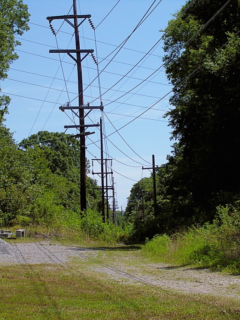
On the south side of Elm Hill Pike east of Ermac Drive, stone support walls of the railroad bridge which once crossed Sims Branch still exist. The right-of-way reappears on the west side of McGavock Pike north of Elm Hill Pike. The two-mile grade from Mud Tavern to Donelson Pike climbed about 100 feet. The N.E.S. poles are visible from Lakeland Drive a few yards above the Gateway Missionary Baptist Church and, farther east, from Seneca Drive.
West of the intersection of McCampbell Road and Donelson Pike, a driveway occupies the roadbed. Nearby Donelson Station changed the name of the former McWhirtersville.
Eastward from Donelson Pike, McCampbell Road runs on the right of and parallel with the procession of power poles. Before crossing Stewart’s Ferry Pike, the pair of roadbeds begin a parallel course.
The power lines terminate at the Nashville Electric Service substation on Stewart’s Ferry Pike. TSLA’s “Davidson County, ca. 1920, Map #1009” shows that the two roadbeds diverged between Stone’s River and Central Pike. The T&P roadbed then became Chandler Road from Central Pike east. At Old Lebanon Dirt Road, the Tennessee Central track and the T&P roadbed resume their side-by-side positions.
After crossing Tulip Grove Road, Chandler Road becomes West Division and then, beyond Mt. Juliet, East Division. The twin roadbeds continue into Rutland, where the tracks veer to the north. At Highway 109, the road doglegs right and left. Renamed Leeville Pike, it continues into Lebanon.
Update from NHN reader Al Grayson (11/2/2013): The cars and the bridge deck are gone by now . . .. This bridge was brought in when the Massman Drive industrial park was developed. It slopes upwards to the east as the western end of the grade was much higher. The old two-lane Elm Hill Pike passed under the approach bridge, whereas the new railroad line crossed Elm Hill at grade. All that is left of the T&P that still has track is an industrial spur off the main railroad track, which was there when the Massman Drive line was reopened in the late 1960s or early ‘70s. It ends just east of Poplar St. and is visible in some of the satellite views [such as Bing and Google maps].
