The Historic Mud Tavern Community

by Richard R. Neil.

The Mud Tavern community grew out of two events in the early settlement of Middle Tennessee. First, sometime before 1784, Major John Buchanan built a “station,” or fortified home, on the east bank of Mill Creek just downstream from where Elm Hill Pike today crosses the creek. This is thought to be the first permanent dwelling in the Mud Tavern area.  Buchanan lived in his “station” house until his death in 1832.

Buchanan’s Station became famous in early Middle Tennessee history when, during the Chickamauga Wars, it was attacked on the evening of September 30, 1792, by a large party of Cherokee, Shawnee, and Muskogee warriors. The attack was successfully repelled by the small band of men and women who had gathered for safety at the station amid signs that the Chickamauga group was in the area. More important for this article is that the station’s defenders included James Mulherrin and Sampson Williams – two men who had migrated with Buchanan in 1780 from South Carolina to Tennessee – as well as James Todd, Samuel McMurray, and others who had received land grants in the immediate vicinity. The presence of so many neighboring settlers suggests that Buchanan station was already the civic center for a developing community of people that would come to be known as Mud Tavern. 

The second founding event is as legendary as it is historic.  Sometime near the beginning of the 19th century a tavern opened on Elm Hill Pike near what is today the intersection of the Elm Hill and McGavock Pikes. It was said to have been built of mud and cedar, hence the name “Mud Tavern.” There are no records to show who first owned the inn, but Richard Smith purchased property at this site in 1810, and court decisions in 1816 in 1832 seem to suggest that it was indeed Smith who operated a tavern there.  Although there are no ruins to mark its location or documents to prove its existence, stories of the old tavern persist. It is said that Andrew Jackson often stopped there on his way to and from Nashville and that he stayed there for two nights as he prepared for his fateful 1806 duel with Charles Dickinson. In the end, however, the best proof of the inn’s existence and its significance is that the surrounding community chose to call itself Mud Tavern, and so it appears on Davidson County maps into the 21st century.

In 1821 the Rev. Richard Dabbs came from Charlotte County, Virginia, to become founding pastor of the First Baptist Church of Nashville. He purchased 347 acres in the Mud Tavern community and built his home on hills overlooking the Mill Creek Valley. Rev. Dabbs died just two years after assuming leadership of First Baptist Church, but by that time his family had become well established in the area. In the years just before the Civil War, his grandsons expanded the original purchase to more than six hundred acres. The war and its aftermath reduced the fortunes of the Dabbs family, but they continued to play a role in the Mud Tavern community and beyond. John W. T. Dabbs, M.D., was a beloved physician in the Nashville area during the early part of the 20th century.  His son, John W.T. Dabbs Jr., Ph. D, gained an international reputation for his work at Oak Ridge National Laboratory on the nuclear ramifications of extremely low temperatures. Descendants of the Rev. Richard Dabbs were still living on his Mud Tavern farm in 1955, when the airport authority purchased the land in order to extend runways to accommodate jet air traffic.

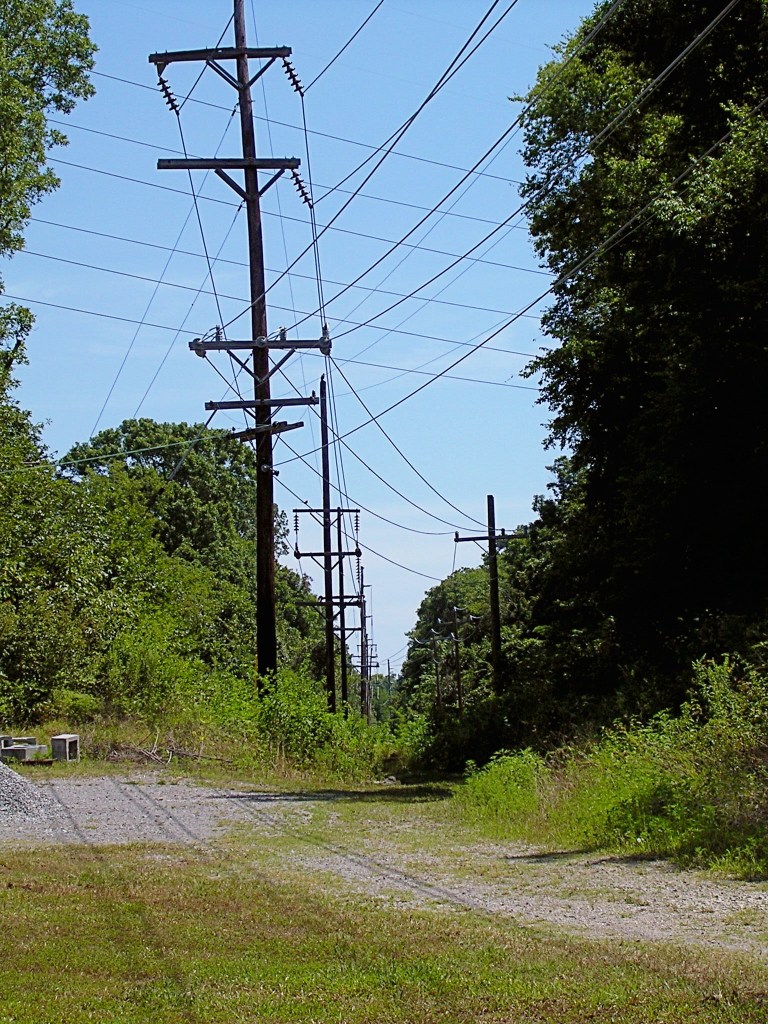
The expansion of southern railroads after the Civil War played a major role in the area’s recovery. The community appeared on the map in 1869 when the Tennessee and Pacific Railroad established a route called the Lebanon Junction and showed Mud Tavern as one of several flag-stop stations along the way. An 1871 Davidson County map – “from actual surveys made by order of the county court” – clearly marks Mud Tavern as a separate and distinct community with the railroad running through it. 

The railroad station had a two-fold and somewhat ironic effect on Mud Tavern residents.  It provided their community with a geographic center of activity: within a fairly short time the area around the station had acquired a post office, a school, and a general store run for many years by Wallace Gleaves. The railroad also gave local citizens access to jobs, schools, and services beyond the immediate community. In 1877 the T&P was purchased by the Nashville, Chattanooga, and Saint Louis Railway, to open up travel an even larger world. Sometime in the 1920s, however, the general store acquired gasoline pumps to service the automobiles and trucks that were beginning to displace the railroads. By 1934 passenger traffic on the Lebanon Junction had declined precipitously, and the NC&SL petitioned the Interstate Commerce Commission to abandon it. The last train stopped at Mud Tavern in 1935. Among those who boarded was longtime resident Will Page, who later told an interviewer, “I took the last trip on the train about two years ago on the thirteenth of July.” It was the end of an era.

From the earliest days, Mud Tavern was primarily a rural, farming community within six or seven miles of downtown Nashville. Farmers took their produce to market by wagon, train, and truck until well into the 1950s. Some of the community’s most enduring institutions supported and influenced its agricultural way of life. Early in the 20th century, Peabody College established Knapp School of Country Life on acreage that included the old Buchanan Station. Along with other practices, the school introduced alfalfa as a hay crop among local farmers. The present-day Purity Dairies had its origins in Mud Tavern on the Miles Ezell farm. For many years Oscar L. Farris, agent for the University of Tennessee Agricultural Extension Service, lived on a hill overlooking the site of the old Mud Tavern inn. Farris and his wife Mary helped farm families of the community adapt as agricultural technology began to change rapidly during the 20th century.

In 1911 the community acquired an institution that would become emblematic of its way of life. The Davidson County Board of Education deeded to Jacob Young the old Mud Tavern school, which sat a few yards west of the crossroads where the Mud Tavern inn had been located.  Young in turn gave the clapboarded building and one acre of land to the Mud Tavern community to be used for “the good of the community,” and it was received by H. S. Allen, D. W. Thompson, James Hite, Leopold Strasser, Thomas Whitworth, and Thomas Page, who were elected trustees.  That one-room school became the meeting place of the Elm Hill Community Club. Over the years it was the site of many ice cream socials, community fairs, a free circulation library, worship services, baseball games, 4-H club and Home Demonstration meetings . . . in short, all of the activities associated with a lively rural society.       

After 1935 the urban ethos of Nashville, which was never far away, slowly but inevitably encroached upon Mud Tavern’s bucolic existence with its siren call of more lucrative jobs and public demands for new roads, commercial development, and residential subdivisions. The airport expanded in 1955, and by the early 1960s Briley Parkway and Interstate 40 had been built through the area, obliterating many of the old farms. Still, as late as 1990 the Elm Hill Community Club building could still be seen hidden in a bramble patch and surrounded by taller commercial buildings, a symbol of an earlier way of life that was gone but not forgotten. Today a group of former Mud Tavern residents meets twice a year to share stories and memories of the area.

In one of Wendell Berry’s short stories, an old man reminisces about his life on his family’s farm: “He is thinking of the membership of the fields that he has belonged to all his life, and will belong to while he breathes, and afterward.  He is thinking of the living ones of that membership – at work today in the fields that the dead were at work in before them. ‘I am blessed,’ he thinks. ‘I am blessed.’” Those whose families lived in the Mud Tavern community count themselves blessed to belong to its membership.


This article was originally published in the January 2010 edition of The Nashville Retrospect. We thank publisher Allen Forkum for his permission to republish it here.  Photograph of Mud Tavern historical marker from NHN collection.  

Touring Elm Hill Pike

by Susan Douglas Wilson.

Elm Hill Pike is one of the most historic roads in Nashville. Few thoroughfares in our city contain so much history packed into so few miles. The road, which probably began as a buffalo or Indian trail, has been mentioned in several accounts of early Nashville history. Andrew Jackson was reported to be a frequent traveler on Elm Hill Pike on his journeys from downtown Nashville to the Hermitage. Mapmakers and old-timers have also referred to this road as “the chicken pike” and the Stones River Road.

As you turn off of Murfreesboro Pike onto Elm Hill Pike, the first historic site encountered is Mt. Ararat Cemetery on the north. Mount Ararat was founded in 1869 by local black leaders and became a burial ground for many of Nashville’s black pioneers. Over the years, the cemetery became a dumping ground and a target for vandals. In 1982 the management of Mt. Ararat was taken over by the Greenwood Cemetery’s board of directors, which voted to change the name from Mt. Ararat to Greenwood Cemetery West and to begin a comprehensive restoration project.

About a mile east of Mt. Ararat Cemetery is Greenwood Cemetery, established on thirty-seven acres in 1888 by Preston Taylor. Taylor, born a slave in Louisiana in 1849, was an influential black preacher, undertaker, and business leader. In addition to Taylor, illustrious Nashville citizens buried at Greenwood Cemetery include Z. Alexander Looby, the Rev. Kelly Miller Smith, Sr., DeFord Bailey, John Merritt, and J. C. Napier.

The gates of Mt. Ararat Cemetery (photograph from NHN Collection)

In 1906 Preston Taylor opened Greenwood Park on approximately forty acres adjoining Greenwood Cemetery. The park was established to serve the black community and included a baseball stadium, skating rink, swimming pool, theater, merry-go-round, bandstand, zoo, and many other attractions. A state-wide fair and a Boy Scout summer camp were also held at Greenwood Park. The admission to the park was ten cents on regular days and twenty-five cents on holidays. The Fairfield-Green streetcar stop was nearby and horse-drawn wagons would pick up patrons and deliver them to the park’s entrance at Lebanon Road and Spence Lane. Preston Taylor died in 1931 and his wife managed the park until its closing in 1949.

Buchanan’s Station was located about another mile east where Mill Creek crosses Elm Hill Pike. The station was established by John Buchanan in 1780. Twelve years later, an oft-recounted Indian battle ensued. On a moonlit night in 1792, a band of three hundred Creek and Cherokee, under the leadership of Chiachattalla, raided the station. The twenty-one settlers fought bravely and defeated their attackers, killing Chiachattalla. Major Buchanan lived at the station until his death in 1832. He is buried, along with his wife and other settlers, in the station’s cemetery.

John and Sally Buchanan’s gravestones in Buchanan Station Cemetery. (from NHN Collection)

Peabody College established the Seaman A. Knapp School of Rural Life in 1915 on one hundred fifty acres on Elm Hill Pike. More acreage, including the site of Buchanan’s Station, was acquired in 1922. The farm was the first institution in the United States devoted to the study of the problems of rural life. Peabody College officials believed that teachers should become acquainted with agricultural life since so many of them would be teaching in rural areas. The experimental farm became a showplace with award-winning dairy and beef cattle herds. Innovative techniques in irrigation, pasturage and field equipment were tested at the farm; and many crops were raised including a certified corn station and a contoured, 25-acre orchard. Knapp Farm provided Peabody College with all its meat, vegetables, and fruit until World War II. The importance of the farm declined after the 1920s because of state-supported agricultural research. Expensive to maintain, Knapp Farm was sold in 1965 to a contractor who developed it into an industrial park.

Though the exact location of Mud Tavern is disputed, most old-timers agree that it was near the intersection of Elm Hill Pike and McGavock Pike. The tavern, built during Nashville’s youth, was made of cedar logs with a mud and stick chimney. Andrew Jackson was a frequent patron and it is reported that he spent two days there planning strategy in his duel with the ill-fated Charles Dickinson. Years later a community named Mud Tavern grew up in the area and contained a railroad station, school, post office, and grocery store. The Mud Tavern school building was used for many years as a clubhouse by the Elm Hill Community Club.

On the far side of Donelson Pike, at the corner of Elm Hill Pike and Hurt Drive, is the James Buchanan house. This two-story log house was built circa 1809. James Buchanan and his wife are buried in the family graveyard near the house, which is now under the care of the Association for Preservation of Tennessee Antiquities.

At the present time, Elm Hill Pike ends at Bell Road. The eastern-most part of the road has been re-engineered several times. The course of the road itself may change, but the history of Elm Hill Pike will always remain as a significant part of Nashville’s heritage.  (2000)

Ghostly Tracks of the Tennessee & Pacific Railroad

by Guy Alan Bockmon.

According to Elmer G. Sulzer’s fascinating book, Ghost Railroads of Tennessee, the grandiosely titled Tennessee and Pacific Railroad Company was chartered in 1867. It was to connect Knoxville and Jackson, Mississippi, via Nashville and Memphis.

By 1877 the T&P was serving Nashville, Mt. Olivet, Mud Tavern, Donelson, Hermitage, Green Hill, Mt. Juliet, Silver Springs, Leeville (Stringtown), Tucker’s Gap, and Lebanon. By 1888 the system had become a branch of the NC&StL.

Jere Baxter attempted to acquire the right-of-way for his Tennessee Central line. Frustrated by refusals to sell, he built new tracks nearly paralleling those of the NC&StL. Excursion trains operated by the Tennessee Central Museum still use the TC tracks. The last train ran on the T&P tracks in 1935.

South and west of Elm Hill Pike at Mill Creek I found few remains of the T&P; but visible from both Elm Hill Pike and Massman Drive an abandoned railroad bridge is burdened with junked rail cars*. Eastward from there the former roadbed is marked by rows of power lines marching through the industrial area and across Acorn, Wanda and Sanborn Drives, and then across Briley Parkway.

Photo from NHN collection.

On the south side of Elm Hill Pike east of Ermac Drive, stone support walls of the railroad bridge which once crossed Sims Branch still exist. The right-of-way reappears on the west side of McGavock Pike north of Elm Hill Pike. The two-mile grade from Mud Tavern to Donelson Pike climbed about 100 feet. The N.E.S. poles are visible from Lakeland Drive a few yards above the Gateway Missionary Baptist Church and, farther east, from Seneca Drive.

West of the intersection of McCampbell Road and Donelson Pike, a driveway occupies the roadbed. Nearby Donelson Station changed the name of the former McWhirtersville.

Eastward from Donelson Pike, McCampbell Road runs on the right of and parallel with the procession of power poles. Before crossing Stewart’s Ferry Pike, the pair of roadbeds begin a parallel course.

The power lines terminate at the Nashville Electric Service substation on Stewart’s Ferry Pike. TSLA’s “Davidson County, ca. 1920, Map #1009” shows that the two roadbeds diverged between Stone’s River and Central Pike. The T&P roadbed then became Chandler Road from Central Pike east. At Old Lebanon Dirt Road, the Tennessee Central track and the T&P roadbed resume their side-by-side positions.

After crossing Tulip Grove Road, Chandler Road becomes West Division and then, beyond Mt. Juliet, East Division. The twin roadbeds continue into Rutland, where the tracks veer to the north. At Highway 109, the road doglegs right and left. Renamed Leeville Pike, it continues into Lebanon.


Update from NHN reader Al Grayson (11/2/2013): The cars and the bridge deck are gone by now . . .. This bridge was brought in when the Massman Drive industrial park was developed. It slopes upwards to the east as the western end of the grade was much higher. The old two-lane Elm Hill Pike passed under the approach bridge, whereas the new railroad line crossed Elm Hill at grade. All that is left of the T&P that still has track is an industrial spur off the main railroad track, which was there when the Massman Drive line was reopened in the late 1960s or early ‘70s. It ends just east of Poplar St. and is visible in some of the satellite views [such as Bing and Google maps].